AGS Format
Introduction
In 1991, the Association Geotechnical and Geoenvironmental Specialists set up a method for transferring data between industry organisations. This is known to many simply as AGS Data Format. The AGS Format provides a standard way to transfer ground investigation, laboratory testing and monitoring data between the contributing parties of a project which involves geotechnical or geoenvironmental elements.
The AGS Data Format allows for seamless sharing of data between different software used within the geotechnical/geoenvironmental industry.
Typically the data is generated by a ground investigation contractor, laboratory or on-site drilling crew or technicians and then passed to all project team members. The project team then uses the data for design without the time-consuming and expensive re-keying of data with the associated potential errors or incomplete data entry. Following completion of the project, the AGS Data Format is easily archived, for retrieval at a later date without requiring knowledge of the software used to generate it.
The AGS Data Format (.ags) is a text file format used to transfer data reliably, between organisations in the site investigation industry, independent of software, hardware or operating system.
The AGS Data Format Documentation
To download a freely available copy of the document Electronic Transfer of Geotechnical and Geoenvironmental Data.
The current version of Geo-log 4 supports the version "4th Edition Addendum 3" of 10/11/2011.
The AGS Data Format Specifications
Development of the AGS format is based on a dictionary of groups and headers defining the data sets, rules and the file format itself.
In order to provide maximum flexibility, the Data Dictionary approach was adopted. To structure the data in a consistent and logical manner, it was divided into Data Groups within which a series of Fields are defined.
The Data Groups were chosen to relate to specific elements of data which are obtained during an investigation, such as project information, exploratory hole details, strata details and in place testings.
For data of a more complex nature, it was necessary to define two or more linked Data Groups, such as Pressuremeter Test Results and Pressuremeter Test Data. Fields within each Data Group identify specific items such as test depth, date, etc.
Key Fields are necessary in order to uniquely define the data unambiguously.
The Common Data Fields contain the associated data. However, rules are given for the creation of other Fields and Groups, should the need arise to transfer particular data not otherwise covered by the AGS Format.
The AGS file itself is a text file with the data surrounded by quotes and separated by commas. All fields are text.
Rules and Group hierarchy
Geo-log 4 strictly respects the rules and groups described in the documentation AGS4 Format with optional additions as notes in the Notes column of the table below.
Geo-log 4 currently supports importing HDPS, DOBS, PMTG, PMTD groups.
| Group | Contents | Notes | Parent group |
|---|---|---|---|
| PROJ | Project Information | Required in all files (Rule 13) | - |
| ABBR | Abbreviation Definitions | Required in all files (Rule 16) | - |
| DICT | User Defined Groups and Headings | Required in all files which include user defined groups or headings (Rule 18) | - |
| TRAN | Data File Transmission Information - Data Status | Required in all files (Rule 14) | - |
| TYPE | Definition of Data Types | Required in all files (Rule 17) | - |
| UNIT | Definition of Units | Required in all files (Rule 15) | - |
| LOCA | Location Details | - | PROJ |
| PMTG | Pressuremeter Test Results – General | see extensions below | LOCA |
| PMTD | Pressuremeter Test Data | see extensions below | PMTG |
| HDPH | Depth Related Exploratory Hole Information | Optionnal | LOCA |
| DOBS | Drilling-Advancement Observations and Parameters | - | LOCA |
Geo-log 4 extensions of AGS Format
The AGS format allows to define additional data fields (DICT) and abbreviations (ABBR). This possibility has been used in our example to support the Ménard pressuremeter test according to ISO 22476-4 standard.
Extensions for PMTG
| Name (DICT_HDNG) | Status (DICT_STAT) | Type (DICT_DTYP) | Description (DICT_DESC) | Unit (DICT_UNIT) | Example (DICT_EXMP) |
|---|---|---|---|---|---|
| PMTG_TEST | OTHER | PA | MPT Type Test | - | MPT_VLOSS |
| PMTG_TESD | OTHER | X | MPT Type Dependency | - | VL_1 |
| PMTG_ZC | OTHER | 2DP | Elevation of the pressure measuring device | m | 1.00 |
| PMTG_PTYP | OTHER | PA | MPT Probe Type | - | PRB_G |
| PMTG_PCVR | OTHER | PA | MPT Probe Cover | - | CVR_RUBBER |
| PMTG_PST | OTHER | YN | Has Slotted Tube | - | Y |
| PMTG_PLC | OTHER | 0DP | Central Cellule Length | mm | 210 |
| PMTG_PDCI | OTHER | 0DP | Central cell diameter inside slotted tube | mm | 44 |
| PMTG_CALD | OTHER | 0DP | Calibration cylinder diameter | mm | 66 |
| PMTG_TBTP | OTHER | PA | Tubing Type | - | TUB_COAXIAL |
| PMTG_TBLN | OTHER | 2DP | Tubing Length | m | 50.00 |
Extensions for PMTD
| Name (DICT_HDNG) | Status (DICT_STAT) | Type (DICT_DTYP) | Description (DICT_DESC) | Unit (DICT_UNIT) | Example (DICT_EXMP) |
|---|---|---|---|---|---|
| PMTD_PG1 | OTHER | 2DP | Pressure in gaz cell as read on CU at 1s | bar | 4.00 |
| PMTD_PR1 | OTHER | 2DP | Pressure in central cell as read on CU at 1s | bar | 14.00 |
| PMTD_PR60 | REQUIRED | 2DP | Pressure in central cell as read on CU at 60s | bar | 15.00 |
| PMTD_V1 | OTHER | 2DP | Volume injected in central cell as read on CU at 1s | cm3 | 16.00 |
| PMTD_V15 | OTHER | 2DP | Volume injected in central cell as read on CU at 15s | cm3 | 17.00 |
| PMTD_V30 | OTHER | 2DP | Volume injected in central cell as read on CU at 30s | cm3 | 18.00 |
| PMTD_V60 | REQUIRED | 2DP | Volume injected in central cell as read on CU at 60s | cm3 | 19.00 |
| PMTD_DATM | OTHER | DT | Starting date/time of the sequence | yyyy-mm-ddThh:mm:ss | 2012-11-19T10:52:41 |
Extensions for HDPH
| Name (DICT_HDNG) | Status (DICT_STAT) | Type (DICT_DTYP) | Description (DICT_DESC) | Unit (DICT_UNIT) | Example (DICT_EXMP) |
|---|---|---|---|---|---|
| HDPH_BDIA | OTHER | 0DP | Drilling bit diameter | mm | 64 |
Examples of AGS4 Data Format compatible with Geo-log 4
Example of a Ménard pressuremeter survey file
Example of importing a spreadsheet containing drilling parameters
The AGS 4 Data Format Validator
For years the industry has had two AGS checker applications that produce different results that have caused clients to specify that AGS files must pass multiple checkers before submitting data to them. The AGS worked with a team to address this issue. The result is a development library that has been reviewed, tested and ported over to an AGS GitLab open-source repository. The library provides validation against the AGS 4.0.3, 4.0.4 and 4.1 formats and can be used within open-source or commercial software, via the command line. The libraries and Desktop App can be downloaded and used free of charge. The term “validator” has been used rather than “checker”, to clarify that the code only validates against the AGS data format, it does not “check” the accuracy of the data contained in the file. Please note, the desktop application will not replace all the functionality of the current AGS checkers, in particular, it will not include the ability to edit or amend AGS files. This is considered to be out of scope and should be done using appropriate software and workflows.
The validator is available in 2 forms:
- A Windows Application: Download the latest version of the validator
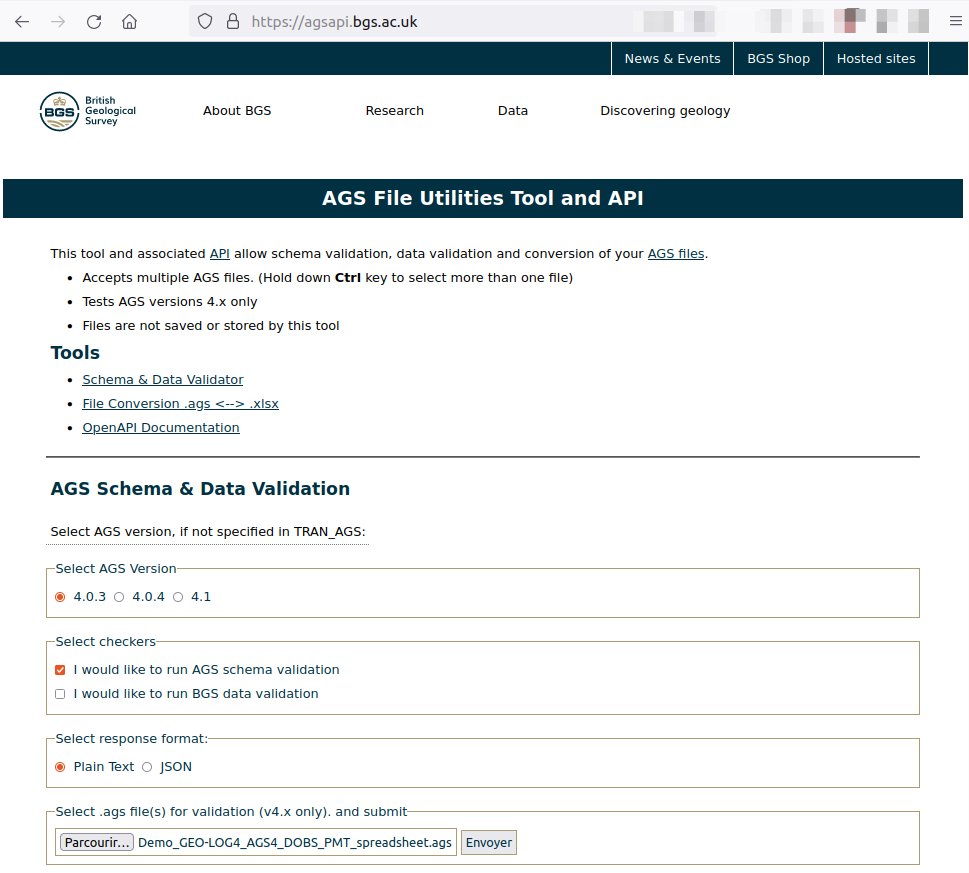
- A web application available on the BGS website Live app
Please see the official AGS Validator page
AGS File Utilities Tool and API - Live app
To check the AGS files destined for Geo-Log 4, you can select the following options: